Share this Post
This article may contain affiliate links. For full information, please see our disclosure here.
Legend has it that The Lost Valley in Glencoe, Scotland was where the MacDonald clan supposedly hid the cattle they had rustled from their neighbours. Once you reach The Lost Valley, however, you do wonder how on Earth they got the cattle here in the first place!
The path to the valley follows the stream Allt Coire Gabhail and offers stunning views of the surrounding mountains. The hike is moderate to challenging.
The Lost Valley – also known as the Hidden Valley, Glencoe – is a hidden gem that is perfect for families with children. Explore legends and history while having fun!
About Glencoe

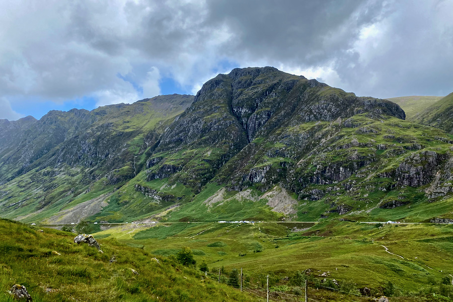
Glencoe, also spelt Glen Coe, is a glen (valley) in the Scottish Highlands, located in the Lochaber area. It is known for its breathtaking scenery, including rugged mountains and picturesque glens.
It is located 26 km (16 miles) South of Fort William, known as a gateway to Ben Nevis, the U.K.’s highest peak, and Glen Nevis valley. The area also includes the Glencoe National Nature Reserve.
The glen is home to several munros, which are mountains over 3,000 feet (914 m), and is a popular destination for hiking and climbing. There are also numerous low-level walks in Glencoe to choose from. Furthermore, it is were Aonach Eagach, a large mountain ridge popular with scramblers and climbers, resides.
Finally, Glencoe is also known for its historical significance and tragic events. In 1692, the MacDonald clan was massacred by government troops in what is known as the Glencoe Massacre. Today, you can learn about this event and the history of the area at the Glencoe Visitor Centre.
About The Lost Valley
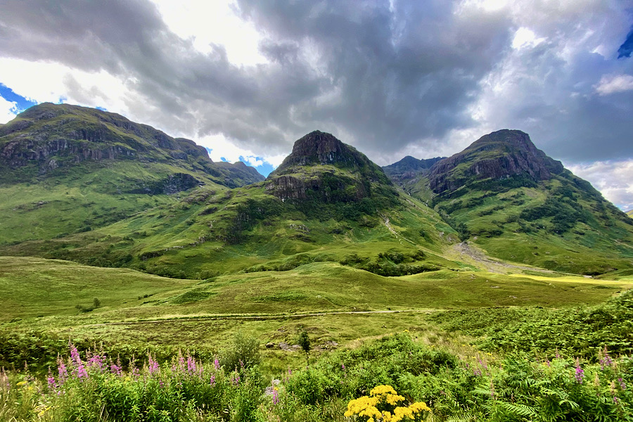
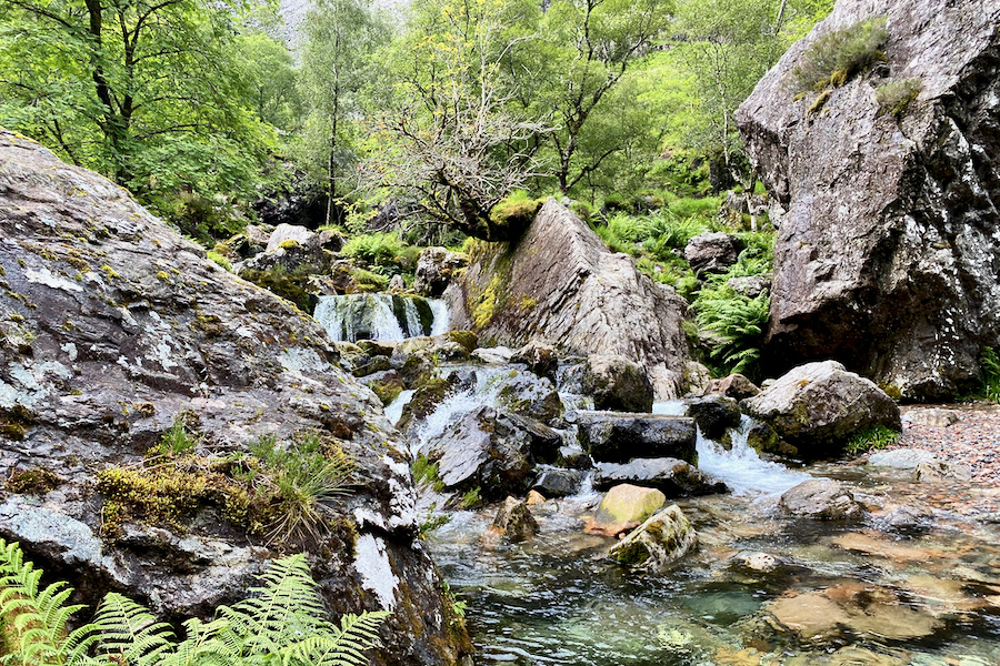
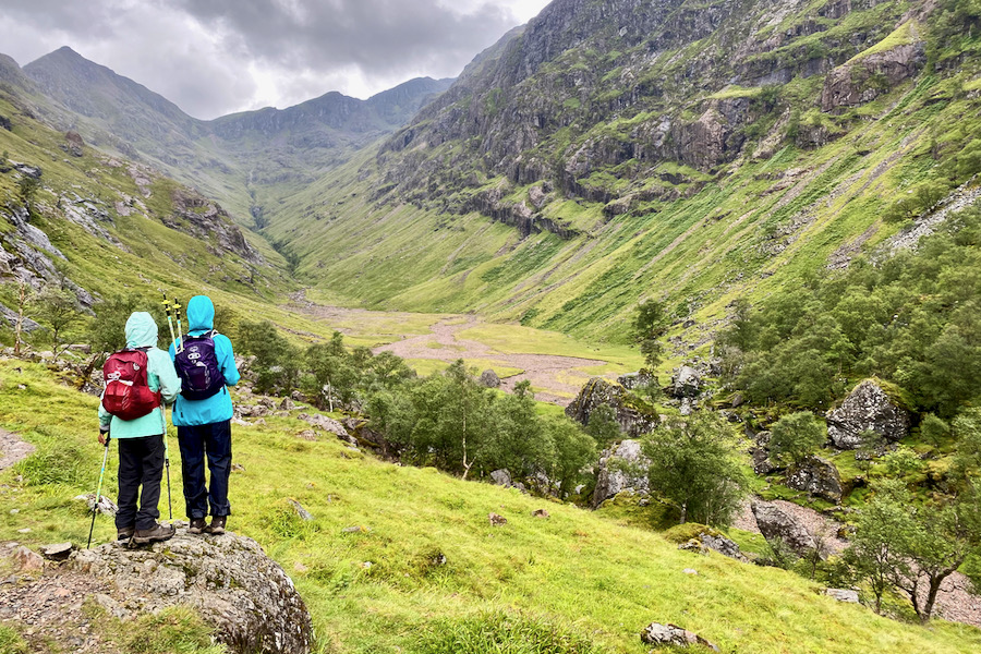
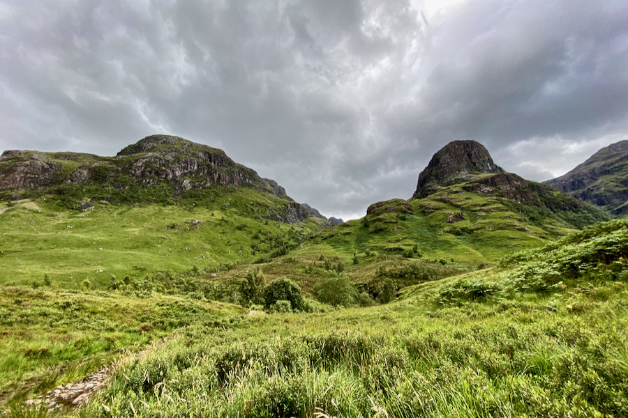
The Lost Valley – Coire Gabhail in Scottish Gaelic – is a secluded valley that offers a unique and exciting hiking experience. It is characterized by its babbling streams, lush greenery, and rocky terrain. The valley is surrounded by the majestic Three Sisters peaks, providing a stunning backdrop to the hike.
LEARN MORE: Best Hikes in Scotland: 12 Stunning Walks in the Highlands
Hiking Stats about The Lost Valley
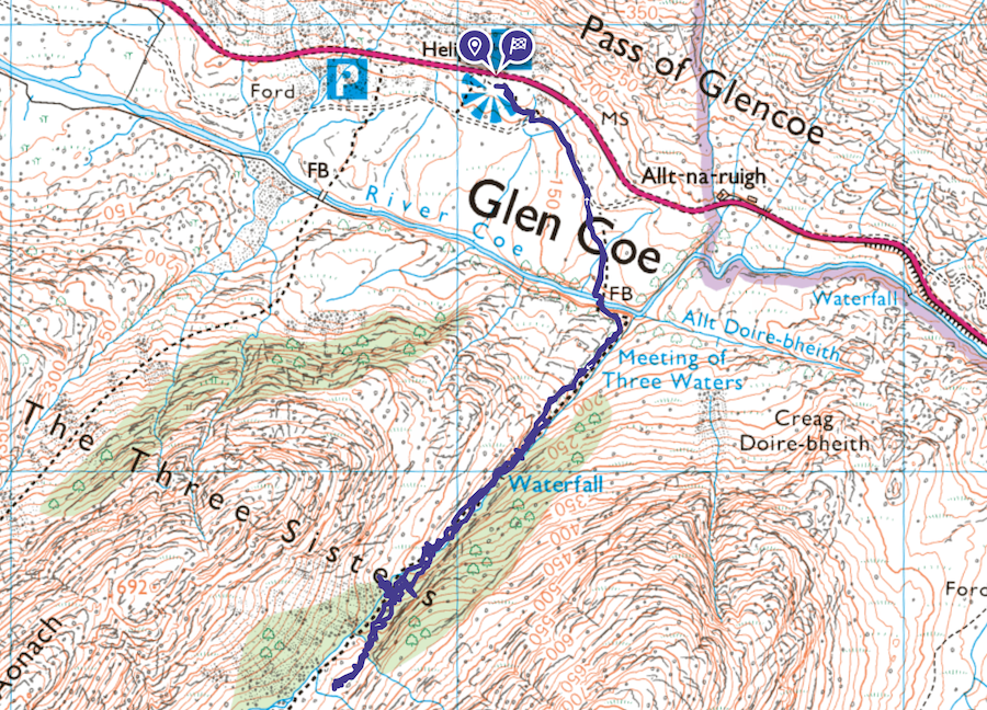
Starting Point: Three Sisters Car Park, A82, Ballachulish PH49 4HX, Scotland | Grid Ref: NN 170 569 | Open in Google Maps
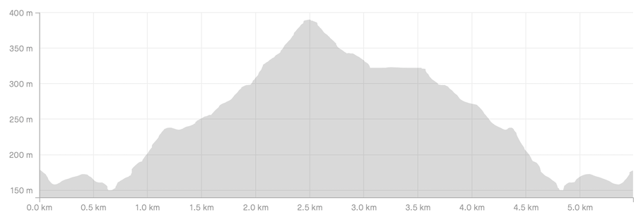
Distance: 4.50 km
Elevation Gain: 308 m
Time: 2 – 3 hours
Difficulty: Moderate – Strenuous
Ordnance Survey Map: OS Explorer 384
The Lost Valley Map & GPX File: View Route Map & Download GPX File
The Lost Valley – Elevation Profile
Getting to the Start of the Hike
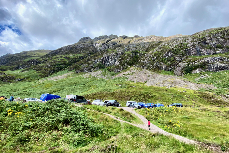
To get to the start of The Lost Valley hike, park at The Three Sisters Car Park, A82, Ballachulish PH49 4HX. Simply Open the address in Google Maps. If there are no free spaces available here, drive further on (in either direction) as there are several more car parks along the road.
The Ascent
The path starts to the left of the car park and leads slightly downhill. Keep left when you reach a fork. The path to The Lost Valley leads between the first and second peaks of The Three Sisters, when viewed from left to right from the car park. This will give you an indication of where your walk will lead you.

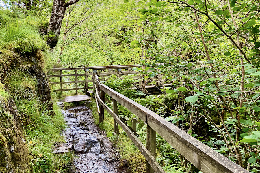
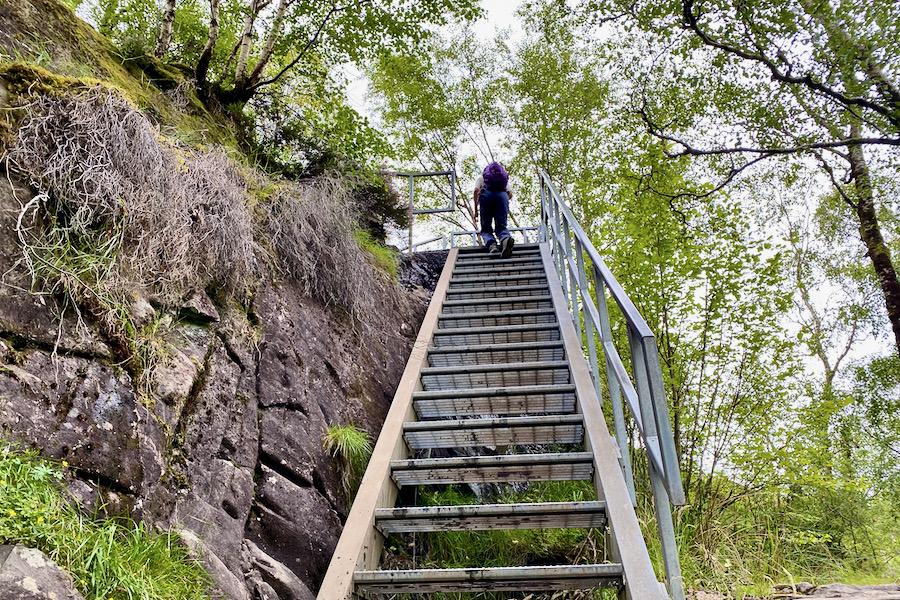
After 500m, you will come across a metal staircase that descends to a footbridge across the River Coe.
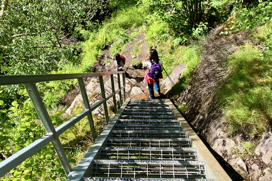
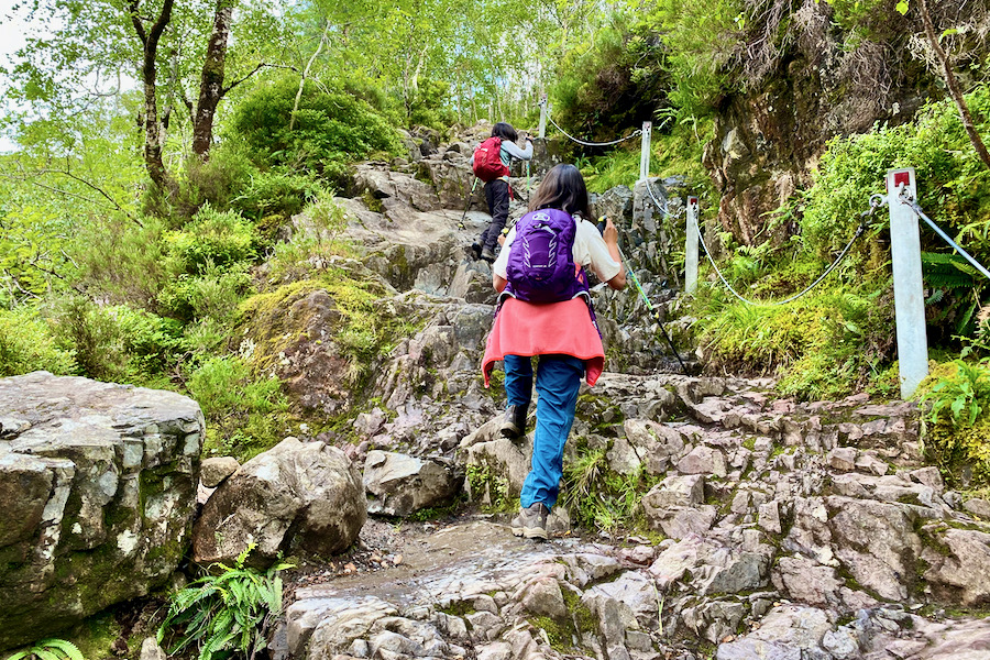
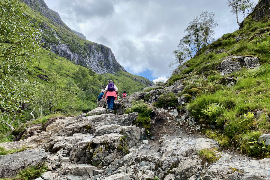
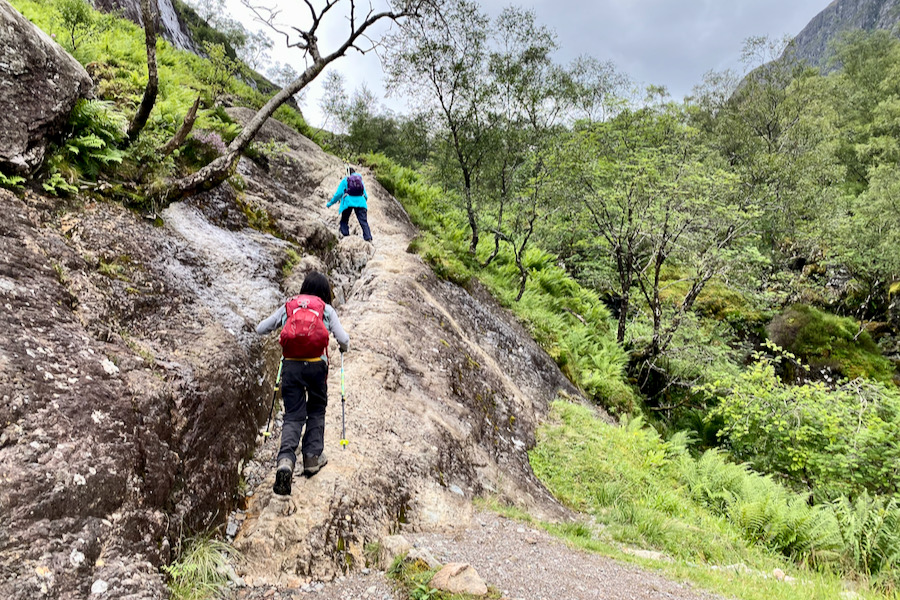
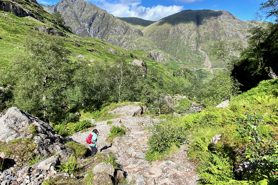
Soon thereafter, the path turns to the right and ascends rocky steps with a wire cable for support. The path can become quite slippery when wet, so exercise caution.
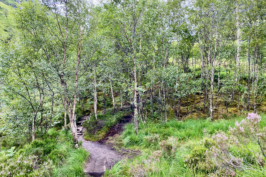
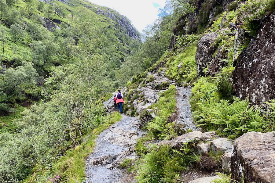
You will walk through a forest of birch trees before emerging into lush greenery.
Take a look back to spot the mountain ridge of Aonach Eagach on the left.
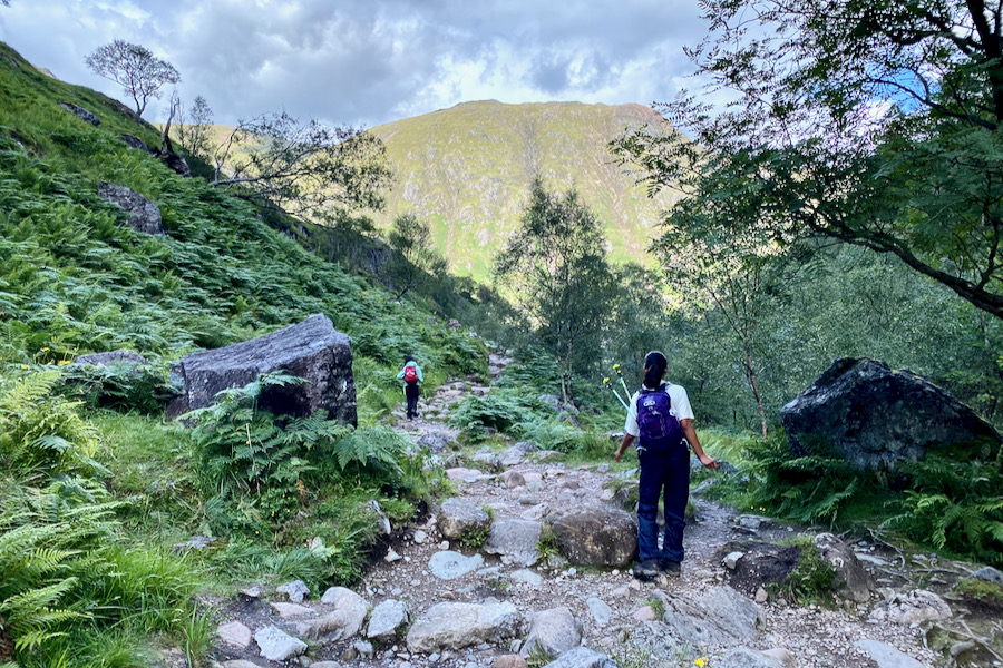
Proceed straight ahead uphill, keeping the stream Allt Coire Gabhail on your left, which you will cross later on.
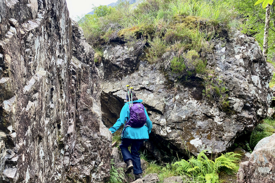
At this stage, the path becomes very narrow and has a 15-metre drop. Proceed with caution and keep children close.

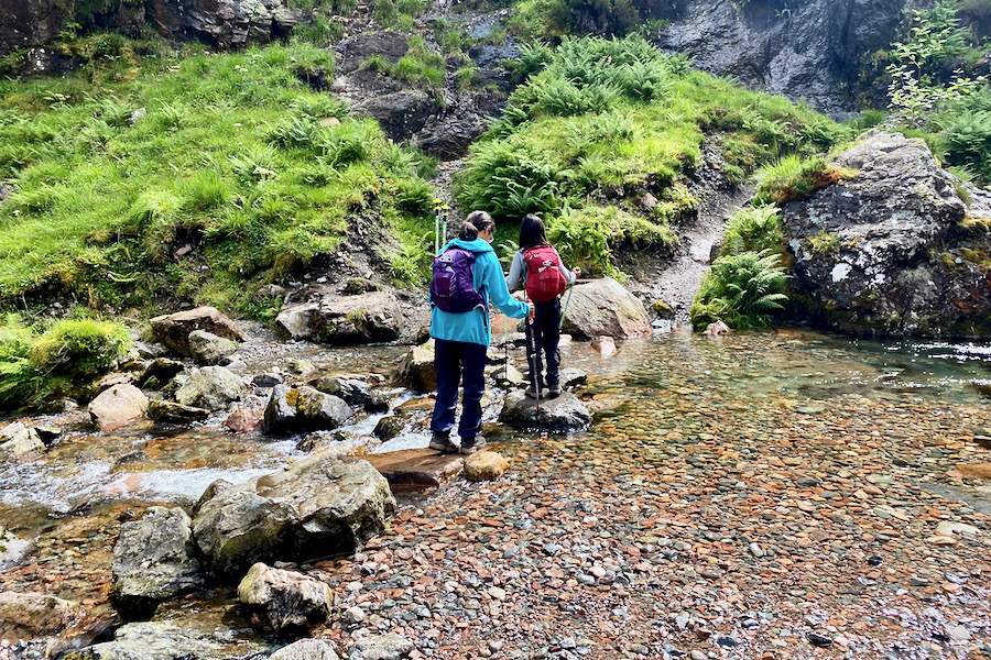
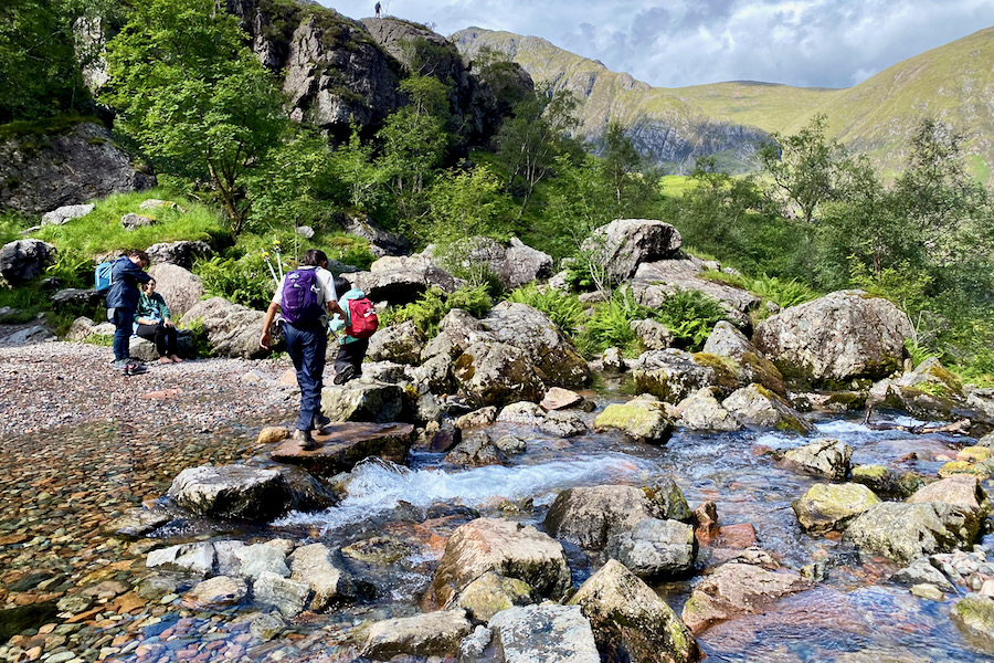
Eventually, you will arrive at the stepping stones to cross the stream Allt Coire Gabhail. If the water level is high, the stepping stones may be covered and you will need to remove your boots and wade through the water. If the water level is too high, however, it may not be safe to cross the stream at all. Use good judgement in this situation.
On our first hike to The Lost Valley five years earlier, we had to wade through the water, but on our recent hike, the water level was low enough to cross using the stepping stones, much to the disappointment of my kids.
Soon after crossing the stream, you will ascend a slab of rock. The rock surface here is highly polished due to frequent foot traffic, so exercise caution, especially when it’s wet.
A final push over a rocky path leads you to the legendary Lost Valley.

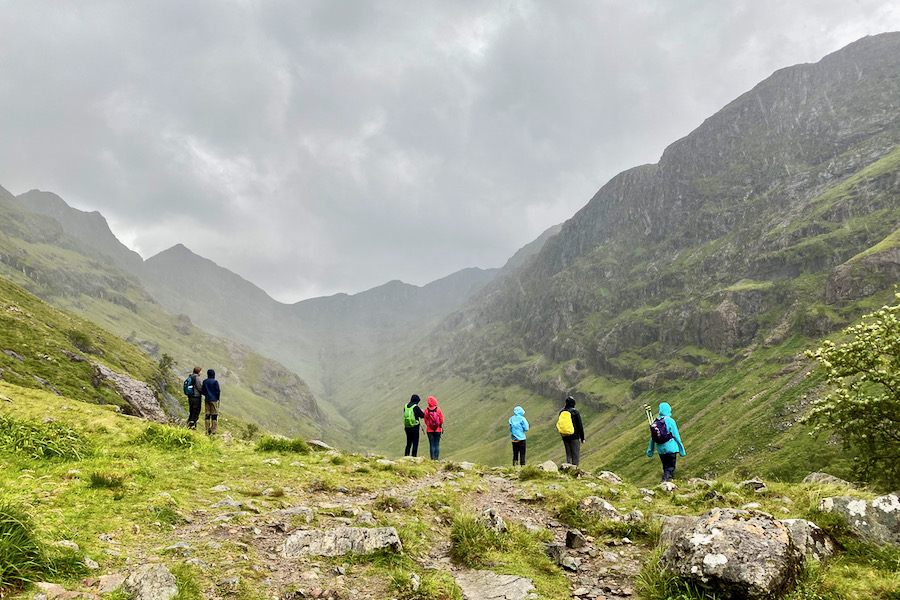
And here it is, The Lost Valley! This place has a mystical feel to it, especially on a moody, cloudy day. There is a hiking path that leads into the The Lost Valley and towards nearby Munro’s, but most hikers, including us, turn back here (after having a picnic lunch).
The Descent
The return walk from The Lost Valley follows the same path as the hike in. My son was eager to find a short-cut by attempting to cross the stream further upstream, which is why our recorded route map shows a zigzag. However, it’s best to stick to the original path and avoid deviating from it to ensure a safe return back to the car park.
The stepping stones across the stream are a highlight for children and provide a fun challenge during the hike. This is also a great place for a picnic or simply to bask in the beauty of nature.
As you retrace your steps and make your way back up the metal staircase, you’ll be greeted by the beautiful expanse of lush green grassland.
Take a moment to look back at your journey and admire the stunning Three Sisters mountains.
Keep right at the fork to return to The Three Sisters Car Park.

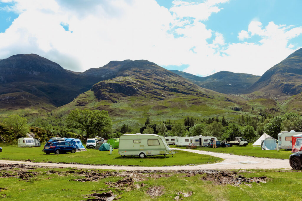
Camping in Glencoe
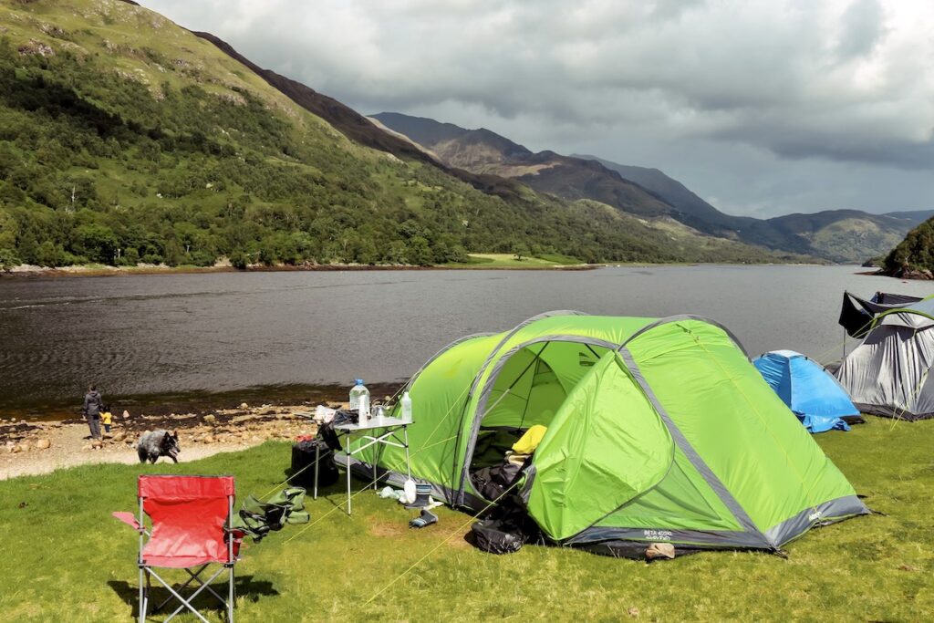
There are several Glencoe campsites to choose from. We camped at the Caolasnacon Caravan & Camping Park during our visit to Glencoe, which offers breathtaking views from its location on the shores of Loch Leven. The owners were very friendly who were able to provide us with a pitch, even on short notice during a particularly stormy day.
Although the winds were strong near the loch shore, our tent held up. If you prefer a calmer night, consider choosing a pitch that is not directly on the shore.
READ MORE: Camping Essentials: Complete Checklist for Camping with Kids
Things to do near Glencoe
- Visit Loch Leven and the spectacular Highland scenery
- Walk to the Steall Falls
- Walk the circular trail around Loch Lochan
- Drive through Glen Etive to Loch Etive; just as James Bond did
- Hike Ben Nevis, the UK’s highest peak
- See Scottish Wildlife
- Visit the Glencoe Visitor Centre
- Bag a Munro
- Take the car ferry from Corran to Ardgour
- Mountain-bike at the Glencoe Mountain Resort
- Visit Neptune’s Staircase on the Caledonian Canal
Resources
When planning our 4-week road trip through Scotland, I drew inspiration from several travel guides to help me plan our itinerary and choose the best hikes and activities. These guides included Scotland The Best, Rough Guide, Cicerone, Bradt, and Wild guide books. I particularly like the structure and information provided in these guides, and they were instrumental in helping me plan our trip.
If you’re planning a trip to Scotland and want to explore the beautiful countryside and hike the stunning mountains, check out these guide books. They are a great resource and will help you plan the perfect itinerary for your trip.
TRAVEL & WALKING GUIDES AND MAP FOR THE LOST VALLEY
- Scotland The Best
- The Rough Guide to Scottish Highlands & Islands
- Ben Nevis and Glencoe: 100 Low, Mid, and High Level Walks (Cicerone Walking Guides)
- Ordnance Survey Map: OS Explorer 384
Hiking Gear for The Lost Valley
To have the best chance of a safe and successful hike, it’s vital that you’re well-prepared and well-equipped. This is true for both yourself and your kids. Do not cut corners when it comes to kitting out your kids with appropriate hiking gear, too.
Well-fitting, water-proof hiking boots with ankle support, as well as hiking socks for comfort, make up the basis for essential hiking gear. In addition to these items, it’s also important to pack the following items for a day hike:
ESSENTIAL HIKING GEAR LIST
For Adults
- Rucksack (Women’s / Men’s)
- Dry bag
- Water bladder or water bottle
- Emergency Shelter
- Trekking or Nordic Walking poles
- Head torch
- Whistle
- Mini First Aid Kit
- Map (& Compass, if you know how to use it)
- Sun Cream
- Mobile Phone
- Camera
- Nutritious snacks
For Kids
- Rucksack
- Dry bag
- Water bladder or water bottle
- Trekking or Nordic Walking poles
- Head torch
- Whistle
- Nutritious snacks
ESSENTIAL HIKING CLOTHING
For Adults
Hiking boots with ankle support
- Hiking Socks
- Hiking trousers
- Rain jacket & rain trousers
- Spare mid layer
- Sun hat
For Kids
- Hiking boots with ankle support
- Hiking Socks
- Hiking trousers
- Rain jacket & fleece layer
- Rain trousers
- Sun hat
By packing these essential items, you’ll be well-prepared for your hike and have the best chance of a safe and successful trip.
Frequently Asked Questions
How long does it take to hike to The Lost Valley?
The time it takes to hike to The Lost Valley varies depending on a few factors, such as your fitness level, the weather conditions, and the number of breaks you take. The average time it takes to complete the hike is about 2 – 3 hours.
What’s the elevation gain for The Lost Valley hike?
The elevation gain for The Lost Valley hike is about 308 metres.
Parking for The Lost Valley?
Park your car at the Three Sisters Car Park, A82, Ballachulish PH49 4HX, Scotland | Grid Ref: NN 170 569 | Open in Google Maps
What is the best time of year to hike to The Lost Valley?
In general, the hiking season in Scotland runs from April to October, with the driest and warmest weather typically occurring in the summer months (June to August). If you’re looking for the best weather and the longest days, then hiking to The Lost Valley in the summer may be the best option for you. Keep in mind that the weather in Scotland can be unpredictable, so be prepared for all conditions and plan accordingly.
Weather for The Lost Valley?
When planning to hike to The Lost Valley, it’s important to check the weather forecast in advance. The weather in the mountains can be unpredictable and can change quickly. Check the Mountain Weather Forecast by the MetOffice website or app to get the most up-to-date and accurate weather information. This will help you plan your hike and ensure that you’re prepared for any conditions that may arise. It’s also a good idea to pack extra layers and rain gear, just in case.
Is the hike to The Lost Valley dangerous?
The hike to The Lost Valley is not considered a dangerous hike, but you need to take great caution as some parts of the path can become slippery when wet, and others are narrow. Sensible footwear is recommend.
Would I recommend hiking to The Lost Valley with kids in tow?
Definitely! The Lost Valley is an excellent hike for kids. With a length of only 4.5 km, it provides a fun change of scenery, including wading through a stream and navigating around boulders. The legend of The Lost Valley is also captivating. Mychildren were 4 and 7 years old on our first hike to The Lost Valley, and 9 and 12 years old when we returned five years later.
How to get to The Lost Valley?
Glasgow to Glencoe: The Lost Valley is located in the Glencoe National Nature Reserve in the Scottish Highlands. It is 138 km (86 miles) North of Glasgow, a drive that takes approximately 2 hours. To get there, take the A82 which leads directly to The Three Sisters Car Park, the starting point of the hike.
Edinburgh to Glencoe: The fastest route is via the M9 towards Sterling. Then take the A84 through the Loch Lomond and Trossachs National Park to Lochearnhead where you’ll hit the A85 and follow it until Tyndrum. Finally, take the A82 until you reach The Three Sisters Car Park in Glencoe.
Fort William to Glencoe: If you are coming from Fort William, take the A82 South and you will reach The Three Sisters Car Park after 33 km (21 miles), a drive that takes around 30 minutes.
Final Words
We have hiked to The Lost Valley twice, once when my children were 4 and 7 years old, and then again when they were 9 and 12. It was fascinating to observe their growth and see how their perspectives on the hike had evolved over the years.
During our first hike, our children were captivated by the babbling stream and lush greenery, and they thoroughly enjoyed wading through the stream with bare feet. On our second hike, as they were older, they had a better understanding of the historical significance of the area and the need to preserve nature. They also showed greater confidence in maneuvering the rocky terrain.
This is certainly a hike for everyone…!
Happy Hiking!
Related Posts
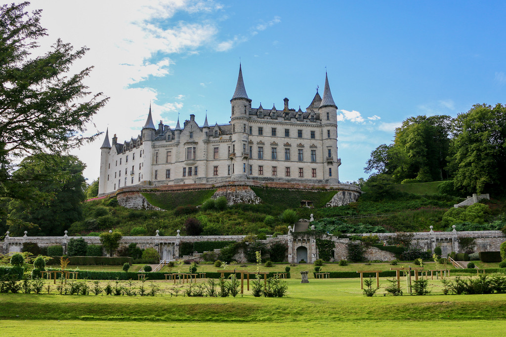
- 10 Best Castles in Scotland to visit in 2024
- Ben Nevis Mountain Track with Kids: The Ultimate Picture Guide
- Best Hikes in Scotland: 12 Stunning Walks in the Highlands

- The Cobbler Scotland with Kids: Complete Picture Guide + Map

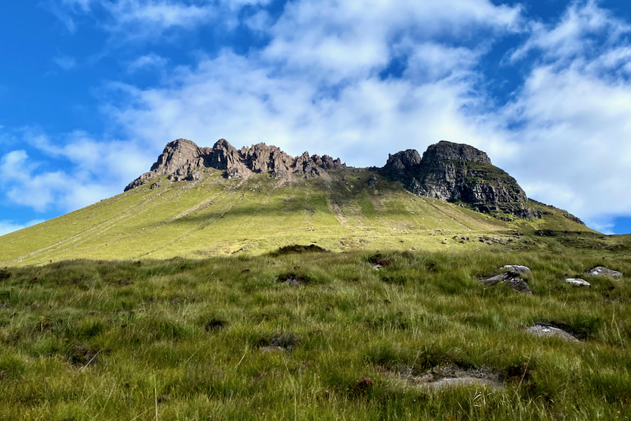
- Stac Pollaidh Scotland: Our Attempt to Reach the True Summit
- Beinn Eighe Mountain Trail: Britain’s Only Way-Marked Hike
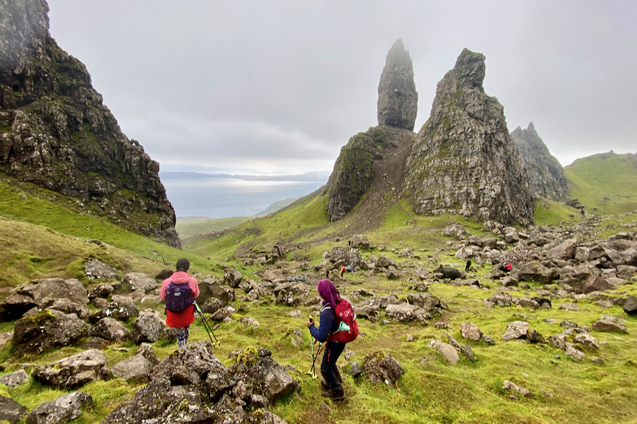
- Lost Valley, Glencoe: A Legendary Hike in the Scottish Highlands
- Old Man of Storr: The Isle of Skye’s Most Popular Hike
- Quiraing: The Isle of Skye’s Most Picturesque Hike

- Fairy Glen: The Isle of Skye’s Most Enchanting Spot

You Might Also Like
- Climbing Overlapping Ridge Route (First Pinnacle Rib), Tryfan
- Snowdon Watkin Path with Kids: The Ultimate Picture Guide
- Devil’s Kitchen Snowdonia with Kids: The Complete Picture Guide
- Top 20 Family Outdoor Activities in Wales
- Scafell Pike Corridor Route with Kids: The Ultimate Picture Guide
- 12 Epic Reasons to Solo Road Trip with Kids (and 5 Against)
- How to Plan a Europe Road Trip – The Essential Guide
- Top 11 Road Trip Activities for Kids
- Camping Essentials: Complete Checklist for Camping with Kids
- Climbing Cadair Idris via the Cyfrwy Arete: A Multi-Pitch Adventure
- The Ultimate Family Road Trip Packing List
Share this Post