
Share this Post
This article may contain affiliate links. For full information, please see our disclosure here.
Located in the Lake District National Park, Scafell Pike is the highest mountain in England with an elevation of 978 metres above sea level.
The Scafell Pike walk is one of the most popular walks in the Lake District. The National Trust estimated that more than 100,000 people climb Scafell Pike a year.
Out of the various Scafell Pike routes – the main tourist path from Wasdale is the easiest and most popular one. This is also the typical route when undertaking the National Three Peaks Challenge which encompasses hiking the highest peak in Scotland, England and Wales within 24 hours.
After some research, I decided that we would take the more challenging but more scenic Scafell Pike Corridor Route; which is also regarded as the best route up Scafell Pike.
This article features Scafell Pike via the Corridor Route from Seathwaite (also referred to as “Scafell Pike Corridor Route from Borrowdale”) in an anti-clockwise direction and how to scale it safely with children in tow.
ABOUT THE CORRIDOR ROUTE
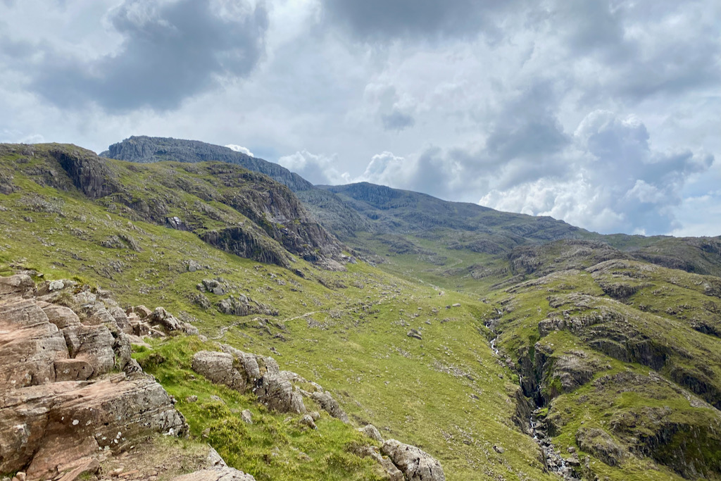
The Scafell Pike Corridor Route from Seathwaite is said to be a scenic and challenging route to the summit of Scafell Pike. It’s 16km in length and involves some scrambling on a couple of sections.
The route starts at the Seathwaite Farm Campsite and after passing Stockley Bridge, follows Styhead Gill and passes Styhead Tarn before it joins the Corridor Route. It then crosses Piers Gill and reaches a junction of footpaths where it joins the path of the walkers coming from Wasdale for the final steep ascent to the summit.
The descent takes in Broad Crag, III Crag and handrails Great End before returning to Seathwaite via Ruddy Gill and Grains Gill.
FACTS ABOUT THE HIKE
Starting Point: Seathwaite Farm Campsite, Seathwaite, Cumbria, CA12 5XJ, England
Parking: On the road up to Seathwaite Farm
Distance: 16km
Elevation Gain: 981 m
Elapsed Time: 8h 37min
Moving Time: 5h 29min
Difficulty: Strenuous
Ordnance Survey Map: OS Explorer OL6
Scafell Pike Map & GPX File: View Route Map & Download GPX File
Scafell Pike Corridor Route – Elevation Profile

OS Maps App: As a backup for a physical map and compass, I also utilise the Ordnance Survey Maps app, which I highly recommend. I find it very useful, especially when precise navigation isn’t always possible with kids in tow or due to low visibility. The app allows you to plan your routes, save them offline, and print them at scale, just to name a few features. You can sign up for the app by clicking the link below.
WEATHER FOR SCAFELL PIKE
As with any activity in the mountains, always check the weather forecast.
The Mountain Weather Forecast by the MetOffice website or app is very useful.
WHY WE CHOSE THE CORRIDOR ROUTE UP SCAFELL PIKE
As with choosing a path up Snowdon last year, I was keen to take a picturesque and challenging route up Scafell Pike this year. (That’s the adventurer in me!) A friend who had taken the Corridor Route with her children suggested that it would be a great route for us. So, I began my research… and the rest is documented in this article.
IS THE CORRIDOR ROUTE DANGEROUS?
Hiking Scafell Pike from Seathwaite via the Corridor Route is said to be more challenging than via the more popular tourist route from Wasdale. The reason is two-fold; at 16km in length, it’s longer and it also consists of a couple of sections where easy scrambling is required. The navigational aspect – not least because it’s a quieter route, hence you won’t be able to simply follow the crowd – shouldn’t be underestimated either.
There is loose scree at places and you also need to use your hands on a few occasions. First, on the “bad step” on the Corridor Route and a second time on the steep, loose scree when descending Scafell Pike and heading towards Broad Crag. We didn’t find it dangerous as long as you’re a confident hiker and are comfortable with very easy scrambling.
Any mountain (or activity, for that matter) is potentially dangerous if you aren’t prepared or ill-equipped.
WOULD I RECOMMEND HIKING SCAFELL PIKE’S CORRIDOR ROUTE WITH KIDS IN TOW?
Yes, I would. Would I recommend it to anyone? No, I wouldn’t.
It all depends on your and your kids’ abilities as well as your confidence. The Scafell Pike walk via the Corridor Route should certainly not be your family’s first hiking adventure!
My biggest concern was whether I would be able to hike it safely on my own with two kids in tow. Attempting it yourself is one thing; but attempting it on your own with two kids in tow is a whole other challenge.
GETTING TO THE START OF THE HIKE
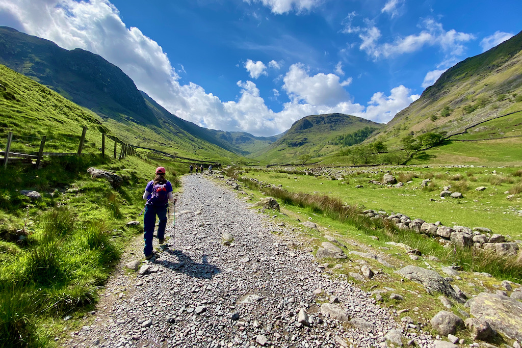
To get to the start of the Scafell Pike’s Corridor Route hike, park on the road up to the Seathwaite Farm Campsite, Seathwaite, Cumbria, CA12 5XJ. There’s free parking on the road but arrive early to secure a space. Since we were dropped off, we didn’t need to worry about parking, so arrived later in the morning.
Head to the farm – and use the public toilets if need be as there are no other toilets en route – and walk straight through it which will lead you to the start of the route.
THE ASCENT
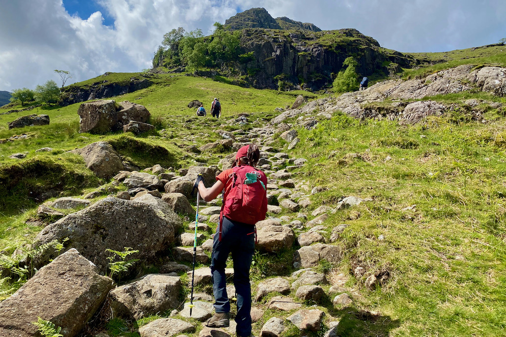
After about 1.5km, you’ll reach Stockley Bridge to cross over Grains Gill. Shortly afterwards, go through the gate and walk straight ahead uphill in order to head towards Styhead Gill to complete this walk in a counter-clockwise direction.
Alternative Route: This walk can also be completed in a clock-wise direction, in which case you would need to turn left after the gate and walk along Grains Gill.
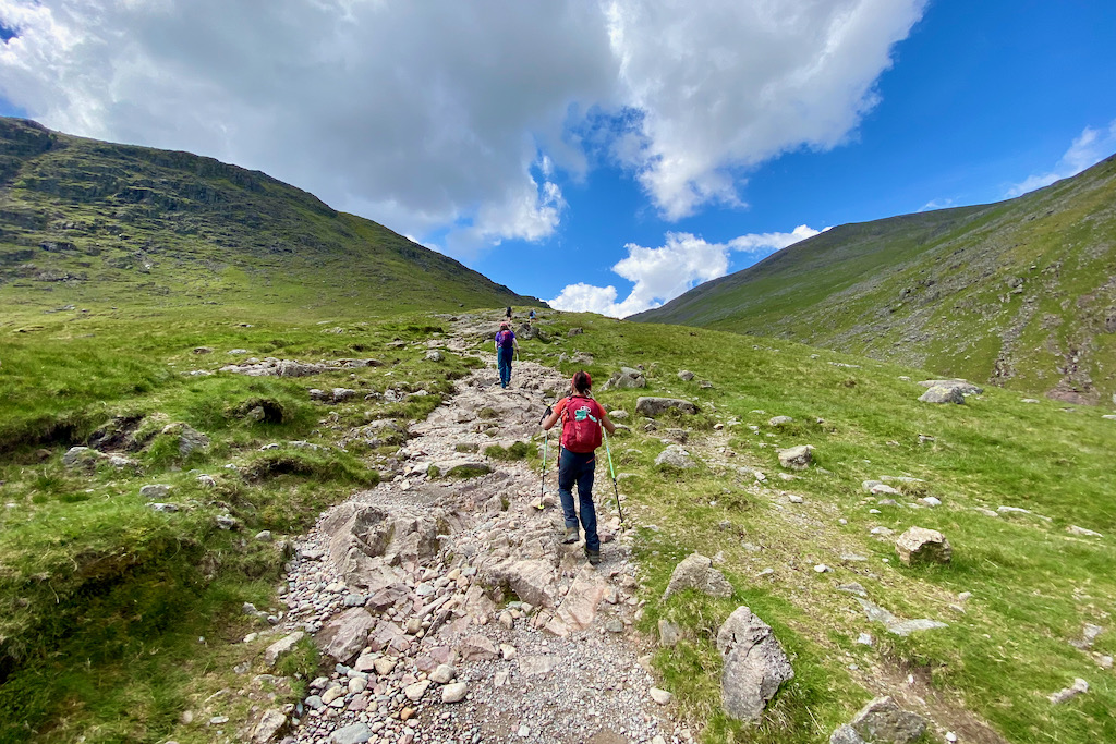
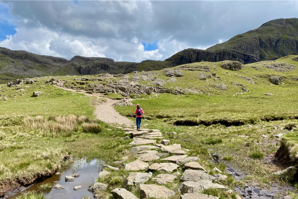
As you walk along Styhead Gill, you’ll reach a foot bridge to cross over.

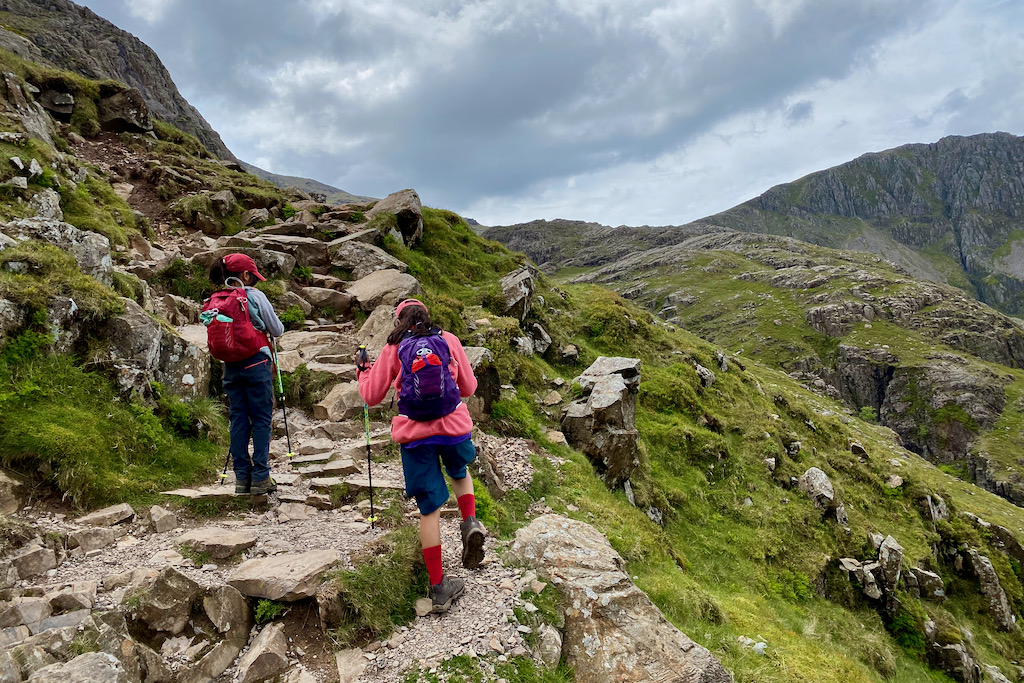
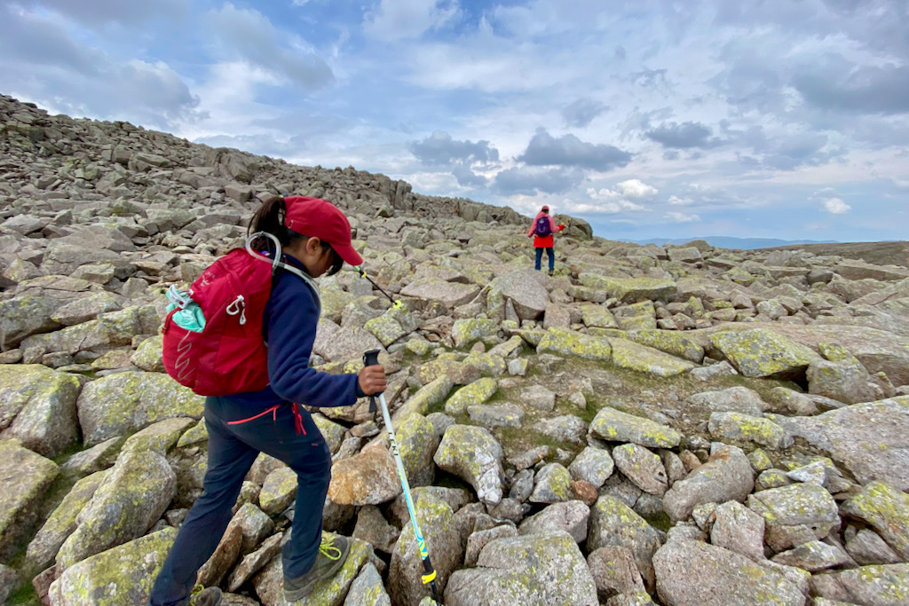
For my kids, the most exciting part of a hike is to cross streams and scramble up (or down) rocks. There are certainly plenty of streams as well as a few scrambles on this hike!
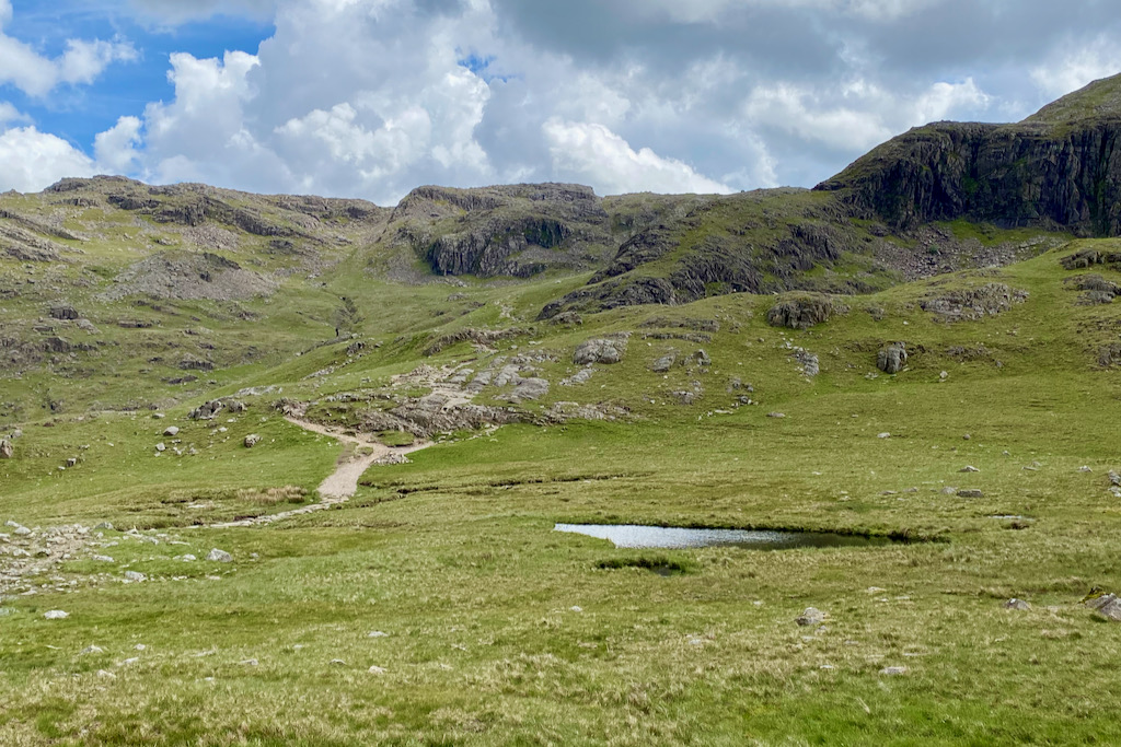
Once you reach Styhead Tarn, keep following the path, leaving the Tarn on your left.

You’ll soon reach a junction of paths where navigating can become a bit confusing. While I was aware of this complicated section, I still took the wrong turn initially.
In order to avoid a navigational mistake here, turn left when you see the little pond leaving it on your right while passing it. Then follow the path until you hit the small cairn to the right of the path before the rocky outcrop on the grass starts to emerge. Don’t rely on this cairn, however. Instead, remember to turn right before you hit the rocky outcrop.
The picture below shows the cairn when looking back at it from the faint path on the grass. (Yes, that’s indeed a path on the grass, albeit a very faint one.)
The picture below shows the view from the cairn onto the very faint path on the grass. We did this hike in early June – I would hope that the path would become more distinct as the season went on.

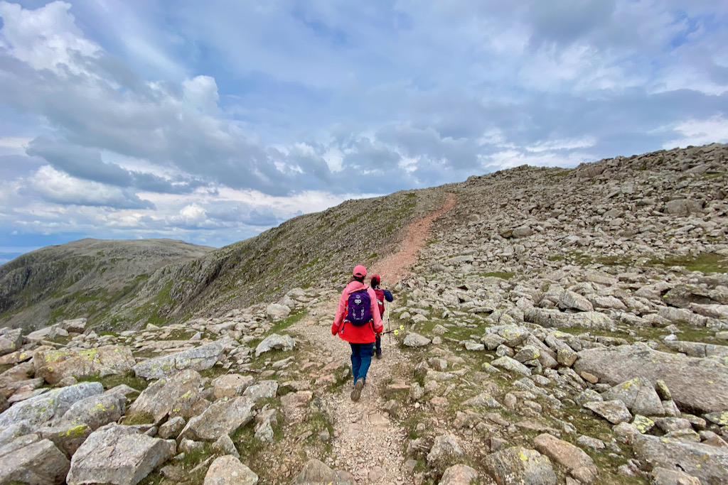
From here, head towards a south-southeasterly direction towards Skew Gill. The path becomes more distinct again.
Walk over the short, steep section to follow the path towards Skew Gill.
Importantly, don’t forget to look back sometimes to admire the scenery as well as to see where you came from and how much progress you’ve made. After all, it’s the journey that matters, not the destination.
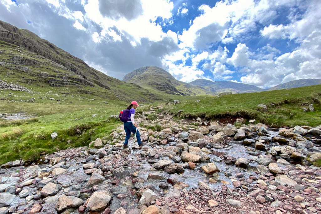
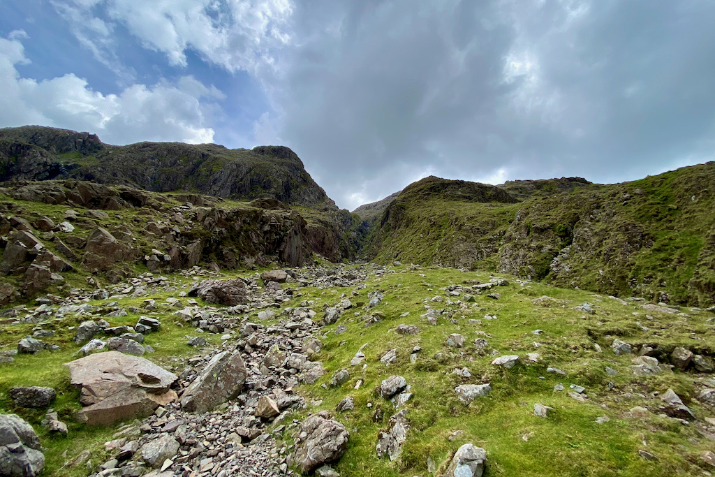
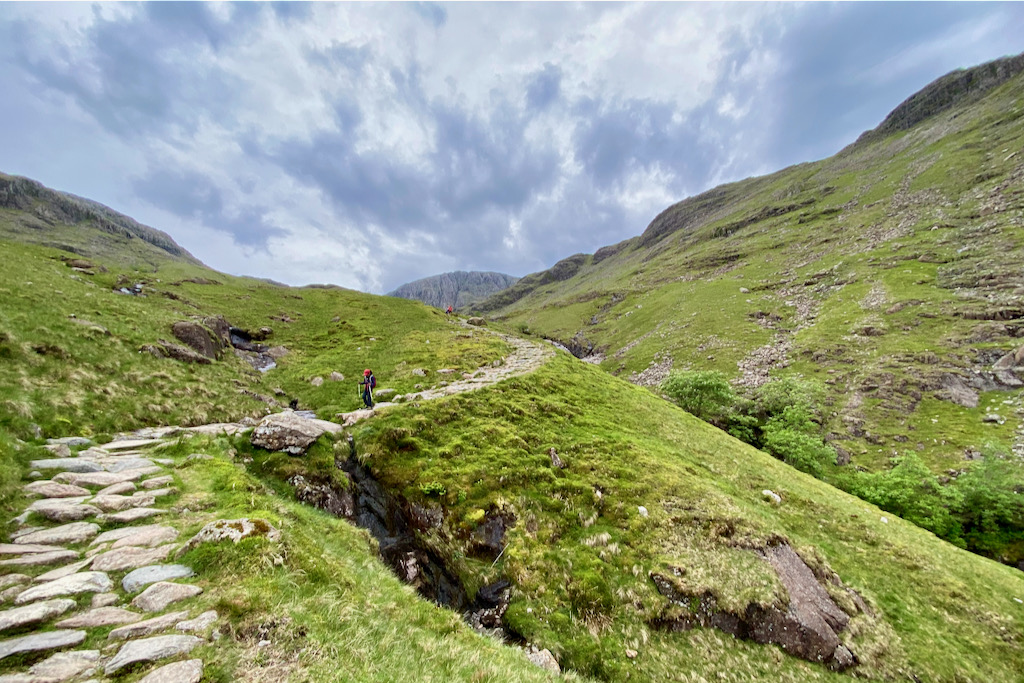
After crossing Skew Gill, follow the Corridor Route towards Greta Gill.

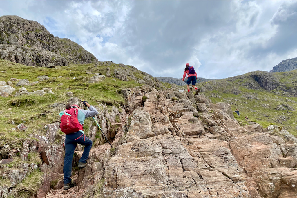
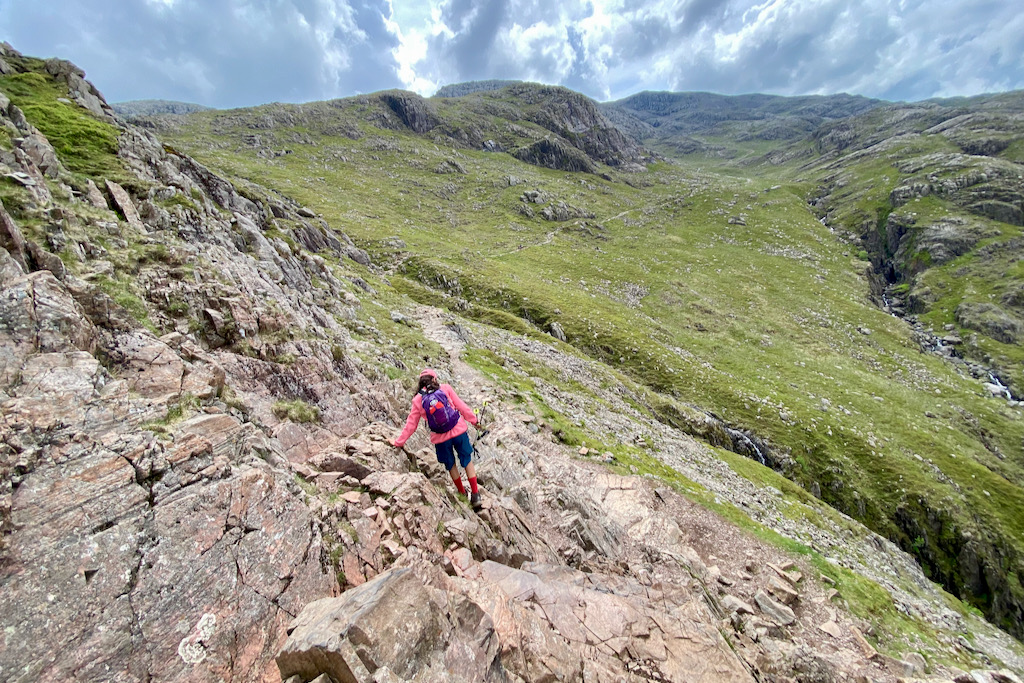
Finally, you’ll reach the start of the “bad step” where you’ll need to down-scramble. Although it’s an easy scramble, care needs to be taken if the rock is wet as it can be slippery.

After the down-scramble, the path crosses Greta Gill and continues on the Corridor Route.

Looking back to where we came from with the “bad step” in the left-centre of the picture below. You can even spot some people on it if you look closely.

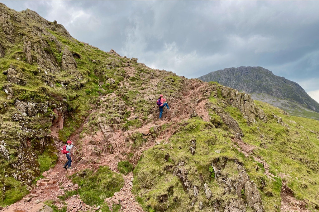
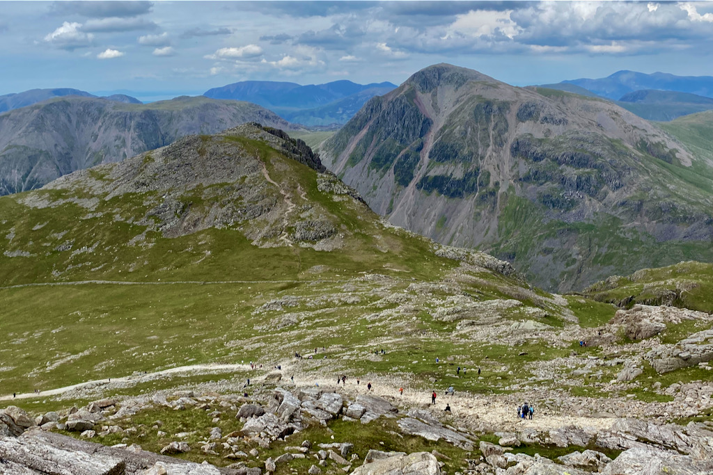
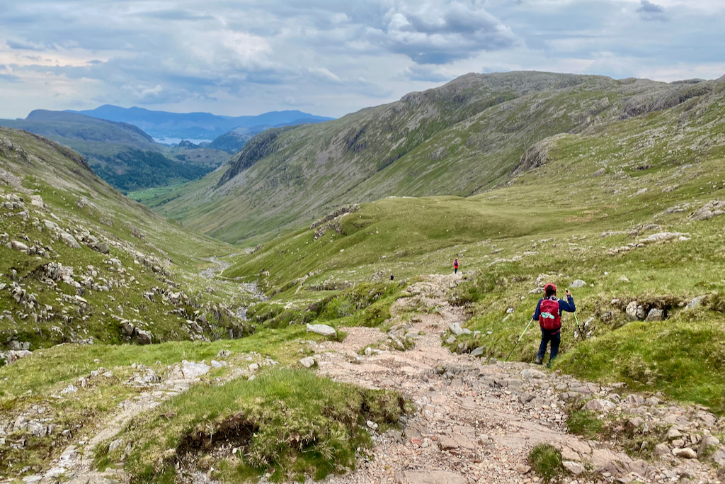
Continue the path towards Piers Gill and don’t forget to look back to admire Great Gable on the left.

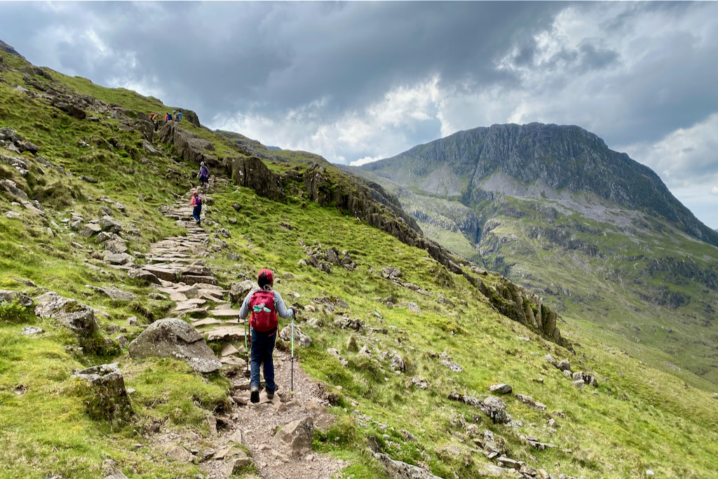
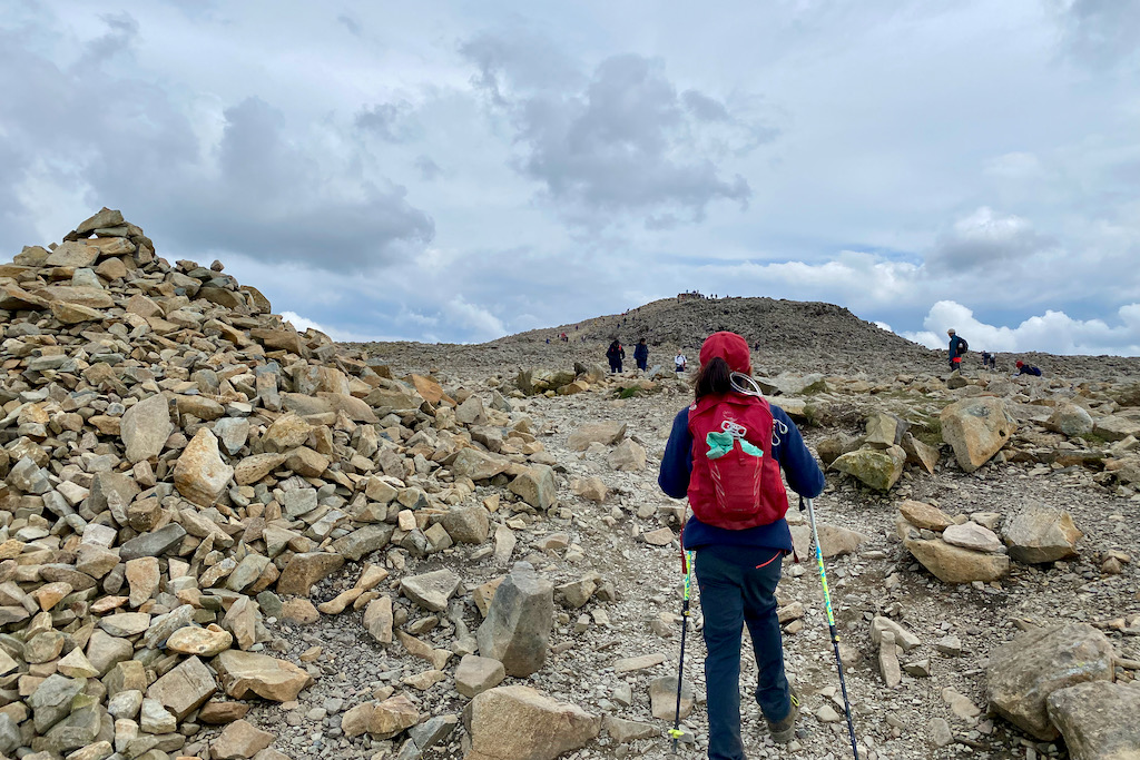
For the final stretch to the summit, turn left and walk up the steep and rocky section joining the other hikers who set off from Wasdale. From here, you’ll reach the summit in less than an hour.
Just when you think you’re about to reach the summit, the summit is actually hidde behind this summit-like feature…

Finally, the summit comes into view! The true Scafell Pike summit!
We made it! Reaching Scafell Pike’s summit was made even more special for us because my youngest wasn’t feeling too well when we sat off in the morning. He had gotten a chill from ghyll scrambling the day before. My poor little boy, he kept saying that he was “dragging his sick body up England’s highest mountain” but he felt better and better as the hike went on. And what a trooper he was!

THE DESCENT
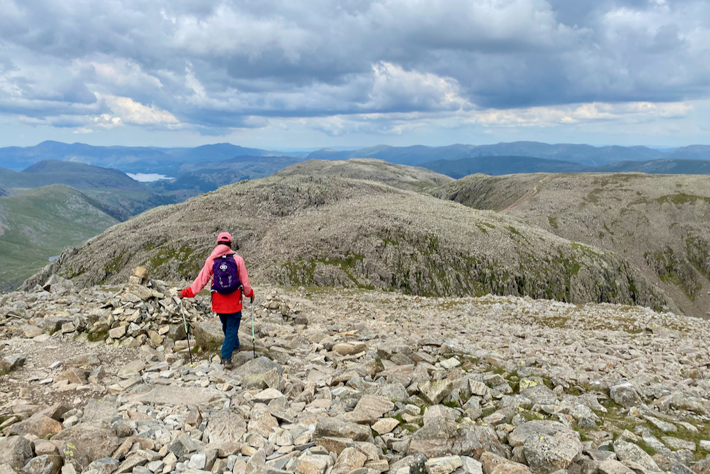
When following Scafell Pike’s Corridor Route in an anti-clockwise direction, the descent from the summit takes in Broad Crag, III Crag and handrails Great End. Finally, it follows down Ruddy Gill and Grains Gill before returning to Stockley Bridge from where you’ll retrace your steps to the Seathwaite Farm Campsite.
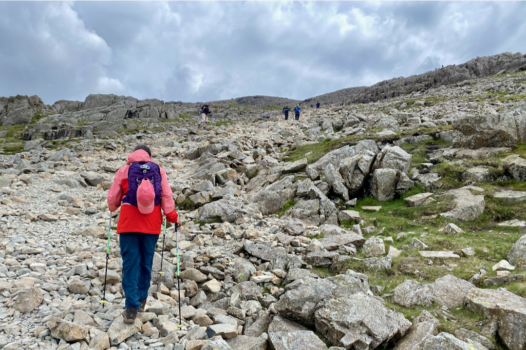
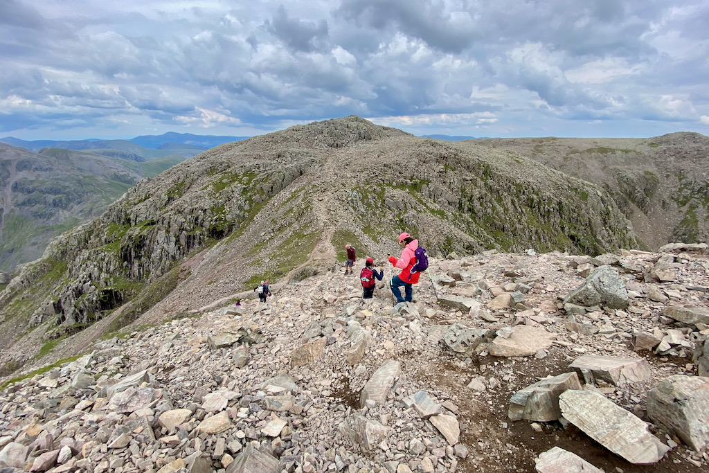
From the summit, go in a north-easterly direction heading downhill towards Broad Crag. You will spot a few cairns along the way to help guide you.
This section is the second scramble on the entire route. It’s very steep and consists of loose scree as well as static rocks that you can hold on to when walking or scrambling down.
Looking back up the steep section which was more of a down scramble than a walk.

The rocks on and around Broad Crag look more like a moonscape as opposed to a landscape in the mountains. The kids loved navigating their way over and around the rocks.
Shortly after leaving Broad Crag behind you, you’ll pass III Crag. The path smoothes out somewhat as the rocks become smaller.
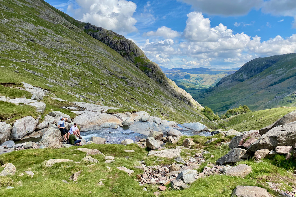
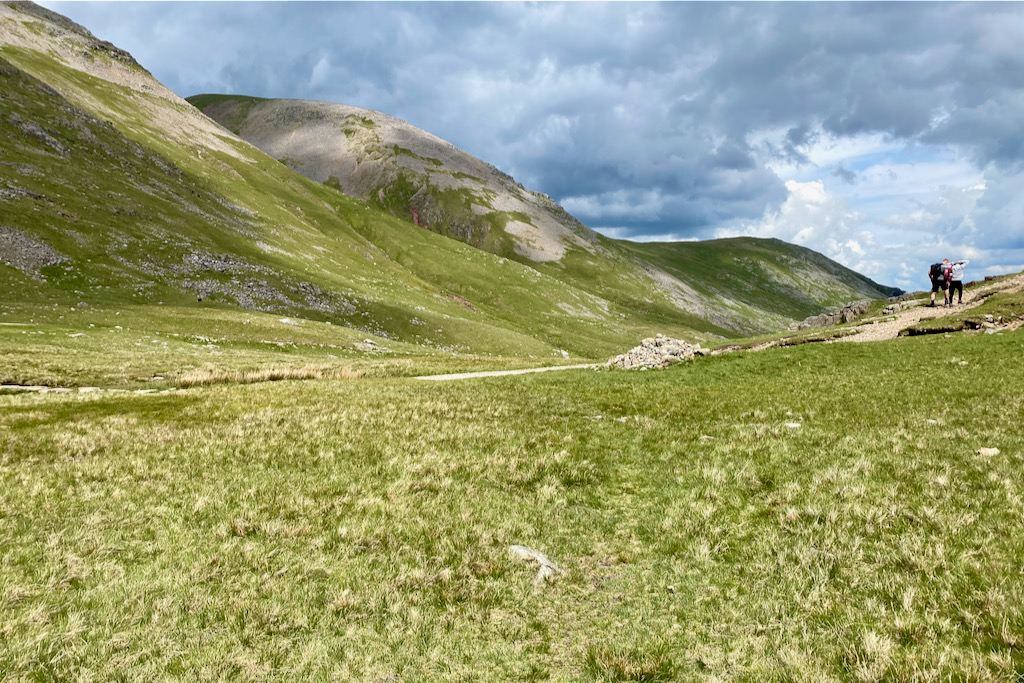
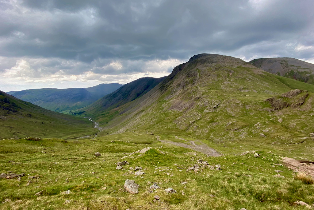
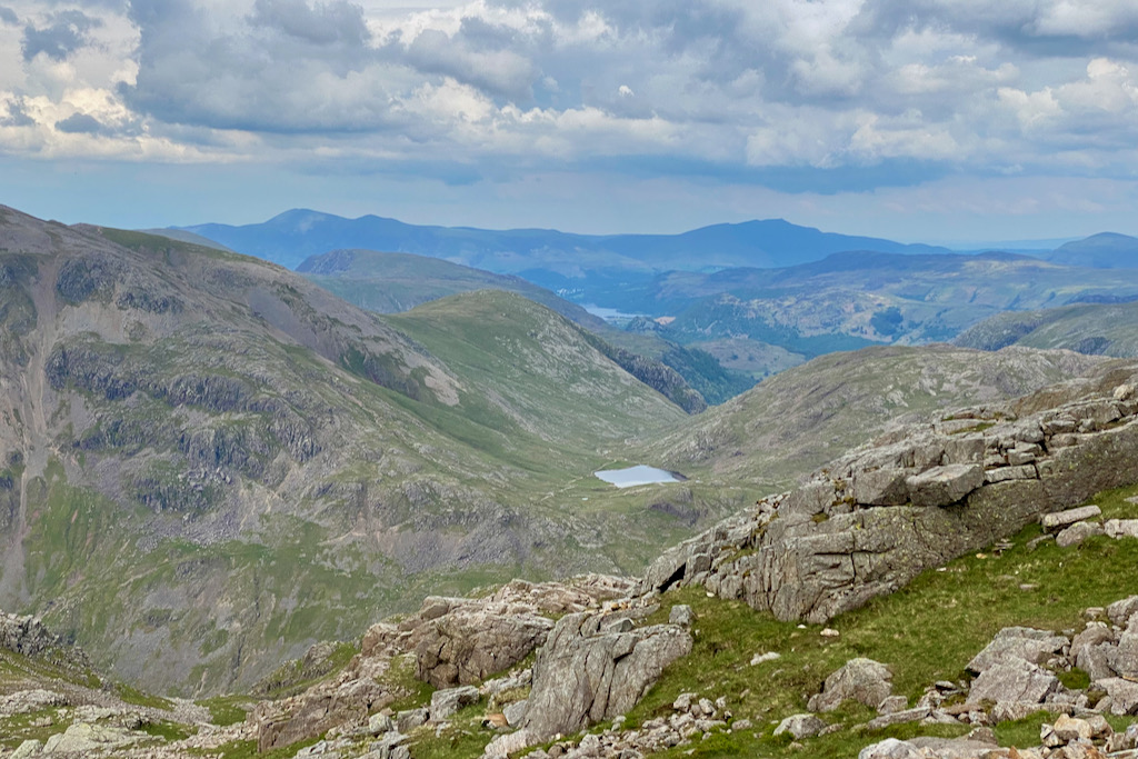
If you still have some energy left, you can do a little detour and walk up Great End which will appear on your left, before retracing your steps and heading down towards Esk Hause. The picture below shows Great End’s scree slope on the left. This detour would take an estimated 45-60 minutes. We gave it a miss.

When you reach a junction at Esk Hause, take the first left to head North. If you go further and take the second left, it’ll take longer and you will need to turn left again. Both paths will rejoin at a fork and continue down Ruddy Gill either way.
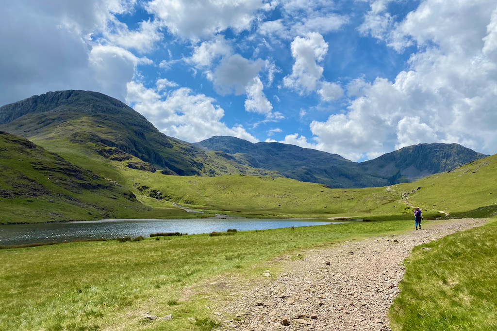
Cross Ruddy Gill to continue on the path. Few hundred metres ahead, you’ll come to a fork which you need to follow to the right.
Following it to the left instead would take you to Sprinkling Tarn which is a great wild swimming spot. There you would also have the option to head back to Sty Head and Styhead Tarn as an alternative route to return to Seathwaite Farm.

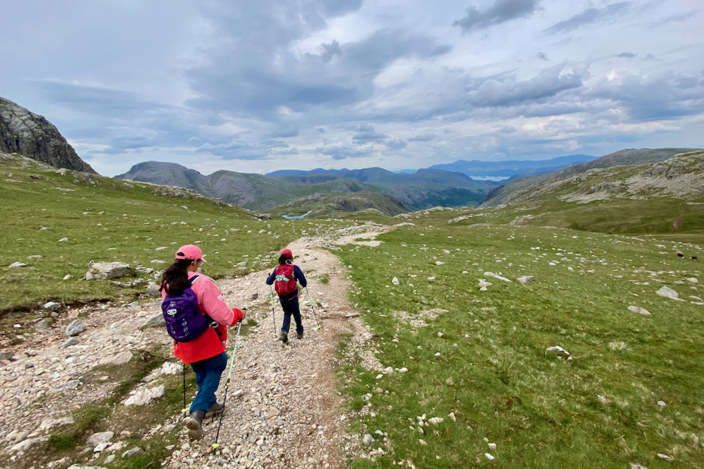
The scenery following down Ruddy Gill and finally Grains Gill is stunning. Don’t forget to look back often to take it all in.
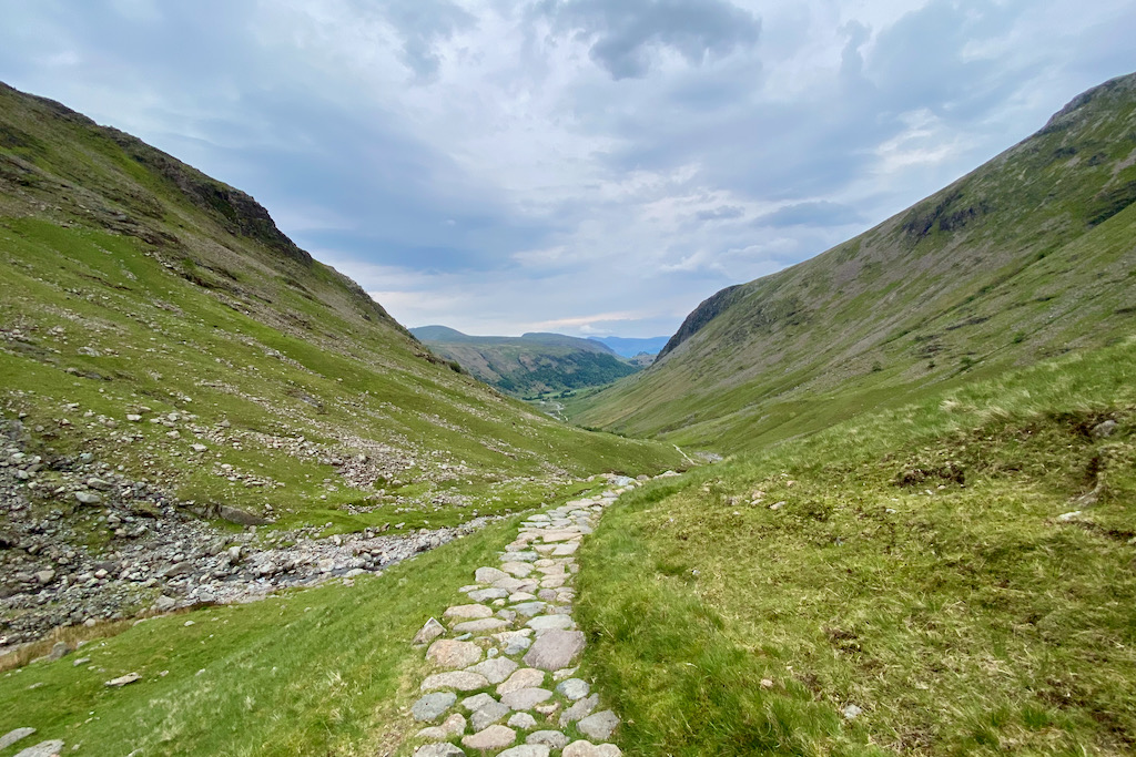
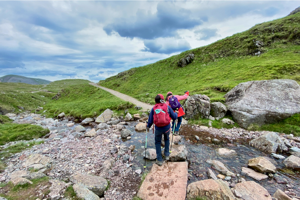
Finally, you’ll reach a foot bridge to cross over Ruddy Gill just before it joins Grains Gill. You’re on the final stretch of your big hike!

Once you reach the gate that you went through several hours earlier at the start of your hike, you’ll retrace your steps all the way back to Seathwaite Farm.
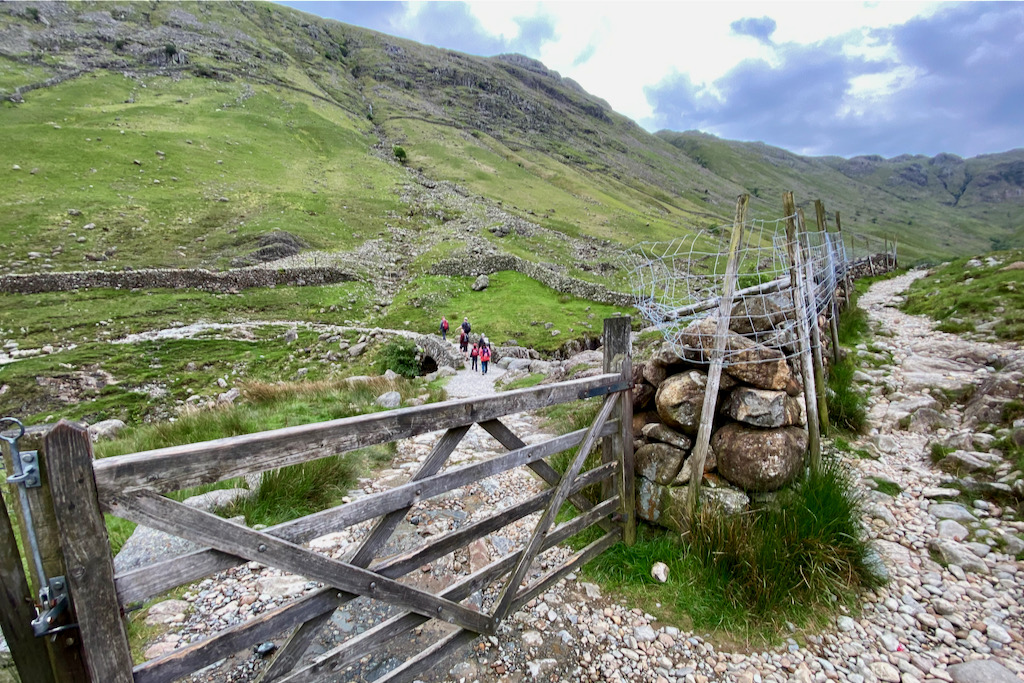
Cross Stockley Bridge for a second time before heading back to Seathwaite Farm which is 1.5km away.

HIKING GEAR FOR SCAFELL PIKE
To have the best chance of a safe and successful hike, it’s vital that you’re well-prepared and well-equipped. This is true for both yourself and your kids. Do not cut corners when it comes to kitting out your kids with appropriate hiking gear, too.
Well-fitting, water-proof hiking boots with ankle support, as well as hiking socks for comfort, make up the basis for essential hiking gear. In addition to these items, it’s also important to pack the following items for a day hike:
ESSENTIAL HIKING GEAR LIST
For Adults
- Rucksack (Women’s / Men’s)
- Dry bag
- Water bladder or water bottle
- Emergency Shelter
- Trekking or Nordic Walking poles
- Head torch
- Whistle
- Mini First Aid Kit
- Map (& Compass, if you know how to use it)
- Sun Cream
- Mobile Phone
- Camera
- Nutritious snacks
For Kids
- Rucksack
- Dry bag
- Water bladder or water bottle
- Trekking or Nordic Walking poles
- Head torch
- Whistle
- Nutritious snacks
ESSENTIAL HIKING CLOTHING
For Adults
Hiking boots with ankle support
- Hiking Socks
- Hiking trousers
- Rain jacket & rain trousers
- Spare mid layer
- Sun hat
For Kids
- Hiking boots with ankle support
- Hiking Socks
- Hiking trousers
- Rain jacket & fleece layer
- Rain trousers
- Sun hat
By packing these essential items, you’ll be well-prepared for your hike and have the best chance of a safe and successful trip.
CAMPSITES NEAR SCAFELL PIKE
We stayed at Fisherground Campsite in Eskdale in the Western Lakes. This is a great location if you plan to hike up Scafell Pike from Wasdale as it’s only a 30-minute drive to the start of the route. Getting from Fisherground Campsite to the start of the Corridor Route in Seathwaite, however, takes about 1h 35min by car.
Alternatively, there is Seathwaite Farm Campsite ideally located right at the start of the Corridor Route. I can’t comment on it though as we haven’t stayed there.
FINAL WORDS
If you’re looking for a different Scafell Pike walk than the main route from Wasdale, then the Corridor Route might be the right one for you. It’s longer, it’s challenging, but it’s also more scenic with a big big scoop of adventure thrown in. No matter whether kids tag along or not – it’ll be a memorable experience and a huge feat you can be proud of. So, get a map, prepare well and enjoy the hike!
Happy Adventuring!
RELATED POSTS
- Climbing Overlapping Ridge Route (First Pinnacle Rib), Tryfan
- Snowdon Watkin Path with Kids: The Ultimate Picture Guide
- Ben Nevis Mountain Track with Kids: The Ultimate Picture Guide
- Best Hikes in Scotland: 12 Stunning Hikes in the Highlands
- The Cobbler Scotland with Kids: Your Complete Picture Guide + Map
- Climbing Cadair Idris via the Cyfrwy Arete: A Multi-Pitch Adventure
- The Ultimate Family Road Trip Packing List
- Camping Essentials: Complete Checklist for Camping with Kids
- 10 Best Castles to Visit in Scotland
- Top 12 Family Outdoor Activities in Snowdonia
- Devil’s Kitchen Snowdonia with Kids: The Complete Picture Guide
YOU MIGHT ALSO LIKE
- 10 Best Castles in Scotland to visit
- 12 Epic Reasons to Solo Road Trip with Kids (and 5 Against)
- How to Plan a Europe Road Trip – The Essential Guide
- Top 11 Road Trip Activities for Kids
- How to Get Your Car Ready for a Road Trip
- Fascinating Non Fiction Books for Kids (Ages 6-12)
Share this Post